Scafell Pike and Lingmell via Brown Tongue from NT Lake Head Car Park Wasdale
This walking route on England’s highest mountain is the most accessible for transport access and navigation, and includes an extra summit – Lingmell. Even though the route is fairly straightforward in clear weather, the terrain underfoot is rocky and steep at higher elevations.
An exhilarating and dramatic route using the Hollow Stones area to ascend via the rocky heart of the mountain and a detour to visit the very shapely Lingmell, with dramatic views of Wasdale. A great choice if you’re looking to develop some walking experience in the area.
Walk Summary:
- Distance: 5.5 miles / 9km
- Ascent: 980m
- Time: 5-6 hours
- Start Point: National Trust Lake Head Car Park, Wasdale
- Grid Ref: NY 182 074
Maps:
- Ordnance Survey: OL6 English Lakes – SW
- Harvey Maps: British Mountain Map – Lake District
Your Starting Point
The National Trust Lake Head Car Park (and campsite) is the go-to access point for climbing Scafell Pike. The pay and display car park area is large with toilet access. It is far more efficient to commit to parking here than trying to find alternative parking further up the valley at Wasdale Head (which is usually very busy and more impactful for the residents of Wasdale Head).
What 3 Words: spelling. cold. alongside

Starting the walk
1. Leave the car park area and pass through a small gate next to a cattlegrid, crossing the large wooden bridge ahead of you, which crosses the waters from Lingmell Gill.
2. Turn left, following signs to Eskdale/Miterdale (footpath to Scafell) and walk along the gravel footpath for a short way, until another junction is reached.
3. The Bridleway to Eskdale/Miterdale breaks off to the right here, but you need to keep Lingmell Gill on your left and carry straight on through a wooded area, passing the building ‘Brackenclose’ on your right. This path will bring you to another bridge crossing Lingmell Gill, where you can access the northern side of the gill for the next section of ascent.
Stream, Gill or Beck? The difference between streams, gills and becks is mainly regional rather than scientific. Stream is the general term for small flowing watercourses. Gills are narrow streams in steep, upland terrain, common in Scotland and northern England, while becks are fast-flowing streams, mainly named in northern England.
4. On the other side of the gill, the stony path rises and passes through a gate. You are now in Open Access Land ascending the lower slopes of Scafell Pike, by way of a well-trodden route that is quite rocky at times.
5. This route follows the base of Lingmell Gill initially until you come to a ‘ford’ over the Gill. This is crossable with care at most times but, when rivers are in spate after heavy rainfall, crossing can be problematic. Check the weather leading up to your walk to ensure you don’t have to turn back at this point!
6. After the crossing, the route uses the grassy spur of Brown Tongue to make a steep ascent towards an area called Hollow Stones above. The path is fairly well engineered with rocky slabs and steps, but is steep and feels tough at times! Take it steady and aim for a comfortable pace ( 2.5 to 3 miles per hour or 20-24 minutes per mile) to reach slightly easier-angled ground above 550m, passing a cairn to mark the start of the Hollow Stones area.
Immerse yourself in your Scafell Pike experience with an expert-led walk. Find out more »
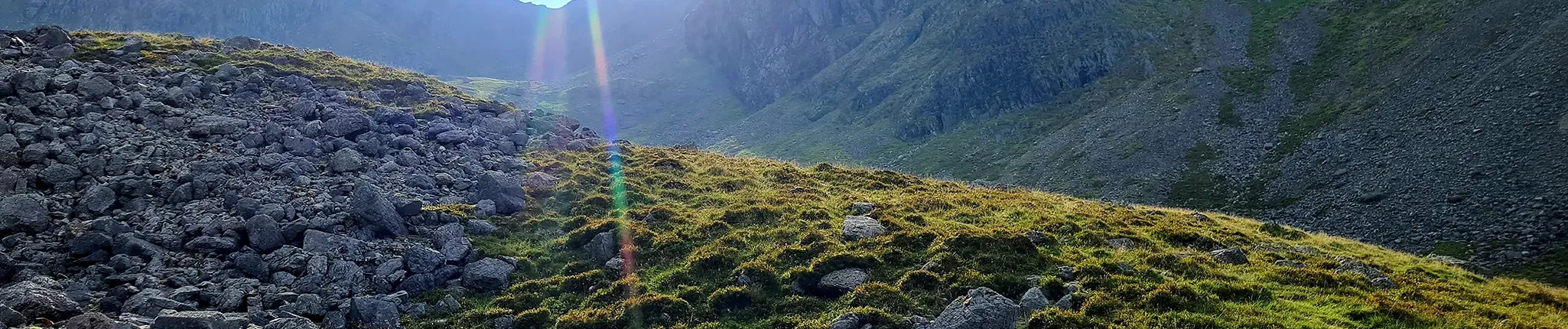
7. The next 1km of route crosses through an interesting and undulating area of Scafell Pike’s massif, with large boulders and dips on either side of the path. The views to Pikes Crag and Scafell Crags that encircle this bowl are very impressive.
8. This section finishes with a zig-zag climb out of Hollow Stones and a good, gravel path, which feels quite welcome after the rocky steps of Brown Tongue.
9. Now above 700m, the route approaches the gap between the summit of Lingmell (on your left) and the final slopes of Scafell Pike, on your right. Arrive at the lowest point of this ‘col’ at 750m, where views open up across to Great Gable and further north. Turn right here, approaching the last ascent towards Scafell Pike’s boulder-strewn summit, apx 1km away.
The summit plateau of Scafell Pike is covered by England’s highest boulder field, formed largely through frost weathering, with debate over whether earthquakes also played a role.
10. The next climb follows a rocky path, marked out by some cairns, generally in a south-east direction. It zig-zags through larger boulders and rocky steps at times, aiming for a large cairn above 900m.
11. After this cairn, the route crosses slightly flatter ground for the last 400m to the summit. The path does become a little indistinct over the final rocks, so keep an eye on your SE direction in poor visibility. The summit cairn is a very large, circular platform of rocks, on top of a natural rocky rise.
12. This walking route uses the same path for your descent – as far as Lingmell Col. Take care to locate the correct direction away from the summit cairn as there are multiple routes away from this rocky plateau. For Lingmell Col, head NW to pick up the route through rocky ground. In clear weather, you should be able to see the large cairn at 900m from the summit.
A ‘col’ is the lowest point on a mountain ridge between two peaks, also known as a gap or pass.
14. Cross a lower stone wall and use a rocky mountain path to ascend the short distance and final 80m of climbing to reach Lingmell’s summit area.
The summit cairn is perched on a series of boulders and rocks, which sit just above the very steep east-facing Lingmell Crag – take care if nearing the edge of this steep ground for photos.
From the summit of Lingmell, you gain a better view of Scafell Pike’s rocky summit area that you’ve walked from. There are also impressive views over Piers Gill below you and north to Styhead Tarn and beyond.

15. For your descent back to Wasdale, check your direction away from Lingmell summit and retrace your steps (now heading south) for 100m or so, before turning downhill onto grassy/rocky slopes towards an old stone wall.
16. Cross the wall and head generally west, keeping higher ground (Goat Grags) on your right and taking care not to descend too low into the valley below on the left.
17. By keeping to a westerly direction, your route will take you to the crest of Lingmell’s long spur that descends in a west-south-west/then south-west direction down towards Wasdale. The steeper slopes of Lingmell Scars, above Brown Tongue, will be on your left. From crossing the old stone wall, the 3km descent is mostly grassy, steep at times, and offers amazing views over Wast Water.
18. At a gate through a stone wall, the route will merge with the Brown Tongue path you took on ascent, which allows you to re-cross the wooden bridge used on your ascent, and follow the gravel trail back to the Lake Head car park.
Be sure to have packed enough food and drink to sustain your entire walk, as the descent from England’s highest mountain is still the same steep and rocky challenge as it was on your way up!
Further reading:
- Read our in-depth Scafell Pike For Beginners Guide »
- Find out what climbing Scafell Pike is like at different times of the year »
- Make sure you’ve got the right kit: check out our Essential Kit Guide »
Scafell Pike – Your Way
We run regular guided walks on Scafell Pike, giving you the chance to join a small, friendly group led by an experienced Mountain Leader. All of our open dates are guaranteed to run, whatever the group size – take a look at our upcoming dates to find one that works for you.
If you’d prefer a more personal experience, you can also book a private guided walk. Whether you’re climbing with friends, family or colleagues, one of our Mountain Leaders can tailor the day to your group, pace and goals.
We’re also long-standing providers of charity Scafell Pike climbs, supporting individuals and groups to raise money for good causes since 2010. Over the years, our walkers have raised thousands of pounds for both local and national charities. If you’re looking to add purpose to your climb, we can connect you with one of our Charity Partners or support your fundraising for a charity of your choice.
Questions?
We’re here to help – get in touch with our team with any Scafell Pike questions.