Scafell Pike and Scafell from Eskdale
A longer and more demanding mountain walk that takes in an impressive circuit of Scafell Pike, Scafell and Slight Side, starting from the quieter valley of Eskdale.
The route involves some scrambling and steep ground, as well as discovering areas that aren’t as well-used as you’ll find on routes from Wasdale or Seathwaite. It’s a fantastic day out for more experienced mountain walkers.
Walk Summary:
- Distance: 11 miles / 17.5 km
- Ascent: 1230m
- Time: 7-8 hours
- Start Point: Wha House Farm car park
- Grid Ref: NY 199 009
Maps:
- Ordnance Survey: OL6 English Lakes – SW
- Harvey Maps: British Mountain Map – Lake District
Your Starting Point
Parking at Wha House Farm is free of charge at the time of writing, although it’s only a small parking area off the road, so it’s always best to make an early start or seek alternative options on foot or cycle to access this start point.
What 3 Words for Wha House Farm: outdone.moral.something

1. Starting the walk
1. From the car park, turn left onto the road and walk east for around 200 metres to reach a permissive footpath on the left. This path hugs a field boundary and gives access to the public footpath heading north-east into the valley bottom.
2. Follow the footpath for another 2.5 km through grazing fields alongside the River Esk, eventually reaching Scale Bridge over Scale Gill.
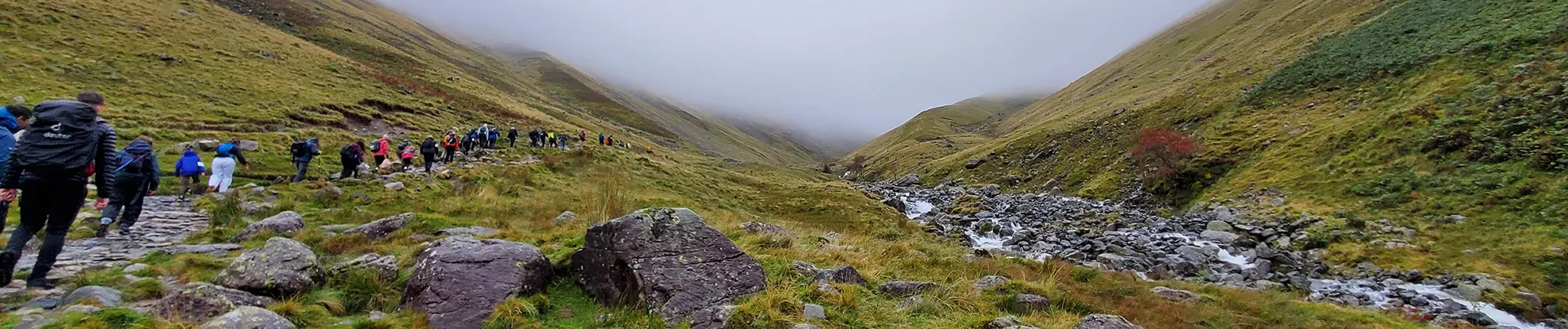
Eskdale is one of the quieter valleys in the Lake District. While routes from Wasdale or Borrowdale attract large numbers of walkers heading for Scafell Pike, Eskdale offers a more peaceful approach with long stretches of remote valley walking.
2. Scale Bridge to Great Moss
1. After crossing Scale Gill, the route begins a steeper ascent of just over 150 metres.
2. The path zig-zags past waterfalls before reaching higher ground around Damas Dubs, offering a lovely mid-level walk through undulating and craggy terrain – which can be boggy in places.
3. Continue north-east through this area for around 4 km, following a varied and interesting path weaving through rocky outcrops and grasses.
4. After around 2 km, the route swings north and then north-west, contouring into the area known as Great Moss – a flatter area of grasses and boggy ground beneath the steep south-eastern slopes of the Scafells.
5. Continue alongside the River Esk for another 1.5 km, walking beneath the very steep slopes of Cam Spout Crag above on your left.
6. Passing Cam Spout Crag brings you to a point where you can turn left uphill to access a rougher footpath gaining height into the rocky cove above. A stream descends here from the ridge between Scafell and Scafell Pike – Mickledore.
3. Great Moss to Scafell Pike Summit
1. Leave the Great Moss area using a rocky path (steep initially), heading north-west towards Mickledore and passing waterfalls as you gain height.
In total, this section climbs around 420 metres over 1.5 km, making it one of the tougher parts of the day. Fortunately, the rocky scenery and the imposing eastern face of Scafell, together with the dramatic rocks of Broad Stand, provide plenty of distraction.
3. Keep climbing towards the narrow rocky ridge of Mickledore, which separates the steep cliffs of Broad Stand from the rounded summit dome of Scafell Pike.
4. Once on the ridge, turn right onto a rocky path that zig-zags north-east for around 500 metres through increasingly large boulders to reach Scafell Pike’s large summit cairn.
4. Scafell Pike to Scafell via Foxes Tarn
To continue to Scafell, you’ll first retrace your steps to Mickledore.

The name Mickledore comes from Old Norse. “Mickle” means large, while “dor” refers to a gateway or gap. The name perfectly describes the dramatic mountain col between Scafell and Scafell Pike.
1. From the summit cairn, check your direction carefully – there are numerous paths leaving the summit.
2. Descend south-west back to Mickledore, then turn left downhill (south) along the path passing the stream flowing from Foxes Tarn at around 650 metres.
3. From here, the route climbs Scafell via Foxes Tarn, a small mountain tarn tucked beneath Scafell’s steep eastern slopes. A rocky path with sections of light scrambling climbs beside the stream. It can be wet in places, so take care.
4. You’ll need to turn right into the gully leading to the tarn, but check water levels first – during heavy rain the entire route can become a stream, in which case descending by the original route may be the safer option.
5. Continuing up to Foxes Tarn involves around 180 metres of additional ascent.
6. From the tarn, turn right to follow a zig-zag path through stony ground that gains a broad shoulder around the 940 metre contour.
7. From here, turn left (south-west) on easier terrain for the final approach to the rocky summit of Scafell (964 m). A small stone shelter and modest cairn mark the summit – usually a much quieter experience than neighbouring Scafell Pike.
5. Scafell to Slight Side
1. Leave the summit of Scafell heading south-east, keeping the steeper slopes on your left.
2. Gradually lose height over rocky and grassy terrain for around 1 km, reaching the end of a narrow shoulder called Long Green.
3. From here the route swings south across easier ground for around 800 metres towards the summit of Slight Side, a rocky prominence marking the southern spur of Scafell.
4. Scramble through large rocks to find the descent route, initially heading south-west, before turning south again.
5. The terrain gradually becomes easier, with rocky ground giving way to a clearer path through grassy slopes.
Although often overlooked, Slight Side forms the southern end of the Scafell massif and offers impressive views back towards both Scafell and Scafell Pike.
6. Slight Side to Wha House Farm
1. Continue descending through easier ground until reaching the 350 metre contour, where the route crosses Catcove Beck.
2. Ford the stream and continue descending generally south for around 1 km.
3. From here the walking becomes much easier, weaving through undulating ground with another 1.5 km to descend back towards Wha House Farm car park.
4. The well-trodden path passes through rocky and wetter areas with lovely views across Eskdale.
5. The final 600 metres follow a stone wall across grazing land, passing through gates before reaching the road and returning to the start point.
Further reading:
- Read our in-depth Scafell Pike For Beginners Guide »
- Find out what climbing Scafell Pike is like at different times of the year »
- Make sure you’ve got the right kit: check out our Essential Kit Guide »
Scafell Pike – Your Way
We run regular guided walks on Scafell Pike, giving you the chance to join a small, friendly group led by an experienced Mountain Leader. All of our open dates are guaranteed to run, whatever the group size – take a look at our upcoming dates to find one that works for you.
If you’d prefer a more personal experience, you can also book a private guided walk. Whether you’re climbing with friends, family or colleagues, one of our Mountain Leaders can tailor the day to your group, pace and goals.
We’re also long-standing providers of charity Scafell Pike climbs, supporting individuals and groups to raise money for good causes since 2010. Over the years, our walkers have raised thousands of pounds for both local and national charities. If you’re looking to add purpose to your climb, we can connect you with one of our Charity Partners or support your fundraising for a charity of your choice.
Questions?
We’re here to help – get in touch with our team with any Scafell Pike questions.