Scafell Pike via Bowfell and Esk Pike – from Langdale
If you’re looking for a challenging, high-level mountain traverse for a good weather day, this is a fantastic option for experienced mountain walkers.
Setting off from the beautiful Langdale valley, this route takes in at least 3 summits (options for more!) including England’s highest mountain, Scafell Pike. A wonderful tour within the Lake District’s south-western fells.
Walk Summary:
- Distance: 11.7 miles / 19 km
- Ascent: 1370m
- Time: 7-8 hours
- Start Point: Old Dungeon Ghyll Car Park (National Trust)
- Grid Ref: NY 285 062
Maps:
- Ordnance Survey: OL6 English Lakes – SW
- Harvey Maps: British Mountain Map – Lake District
What 3 Words for Old Dungeon Ghyll Car Park (National Trust): amuses.charts.partners
Your Starting Point
The valley of Great Langdale is served by buses from Ambleside, which can be a useful option if you’re able to work around the timetable.
During busy summer months the valley can become congested with cars, so it’s wise to arrive early for parking and to start the walk early, especially for a longer route like this.
1. Starting the walk
1. Leave the car park and turn right onto the valley road for a short distance to reach a gate and public footpath towards Stool End Farm.
2. From here, begin climbing the shapely shoulder known as The Band, which forms the lower slopes of Bow Fell.
3. This well-used path climbs steadily for around 3 km, gaining height towards a col known as Three Tarns.
4. At this flattening between the delightfully named Crinkle Crags on your left and the southern slopes of Bow Fell on your right, you’ll also gain your first dramatic views of the Scafell massif to the west – including your final summit of the day, Scafell Pike.
The name Three Tarns is quite literal – the col contains three small mountain tarns. These tiny glacial pools sit between Crinkle Crags and Bow Fell and mark an important junction of mountain routes in this part of the fells.
2. Bowfell Summit
1. From the Three Tarns col, turn right and climb rockier slopes.
2. A zig-zag path gains around 200 metres of additional ascent, passing through increasingly rocky terrain.
3. Soon you’ll reach the broad summit area of Bow Fell, where large boulders are scattered around the highest point.

3. Bowfell to Esk Pike via Ore Gap
1. Leaving Bow Fell, the route initially stays fairly level over rocky ground, heading north-north-west away from the summit.
2. A faint path weaves through the rocks before descending through grassy terrain below the 820m contour.
3. From the summit it’s just under 1 km to Ore Gap, the col between Bow Fell and the next summit, Esk Pike.
The rocks here often appear pinkish-red, due to iron oxide staining in the surrounding stone.
4. Compared with Bow Fell, the ascent of Esk Pike is relatively straightforward. The route climbs another 130 metres, following a rocky path weaving through lumpy terrain. At 885 metres, Esk Pike is lower than Bow Fell but offers excellent views across the Scafell massif.
The Scafell massif refers to the cluster of high summits around Scafell Pike, including Scafell, Broad Crag, Ill Crag and Great End. It forms the highest and most dramatic mountain landscape in England.
4. Esk Pike to Esk Hause
1. Descend from Esk Pike for around 600 metres, heading north-north-west to reach Esk Hause, the col between Esk Pike and Great End.
2. From here, a stony path climbs steadily west through Calf Cove, reaching a flattening just south of Great End.
3. You could make a quick out-and-back detour to the summit of Great End – this will add up to 30 minutes to the day.
5. Across Ill Crag and Broad Crag

2. A path winds through increasingly rocky ground for around 1.5 km, generally heading south-west.
3. The route bypasses the actual summits of these peaks before descending through boulders to a narrow col between Broad Crag and Scafell Pike.
4. From here, climb a steeper slope for around 300 metres, continuing south-west until the gradient eases and you reach the rocky dome of Scafell Pike’s summit.
5. The summit plateau is uneven with large rocks and boulders, and the summit cairn itself forms a large circular structure. Take a moment to enjoy the views back across your high-level route, as well as the sweeping panoramas north and west towards the coast.
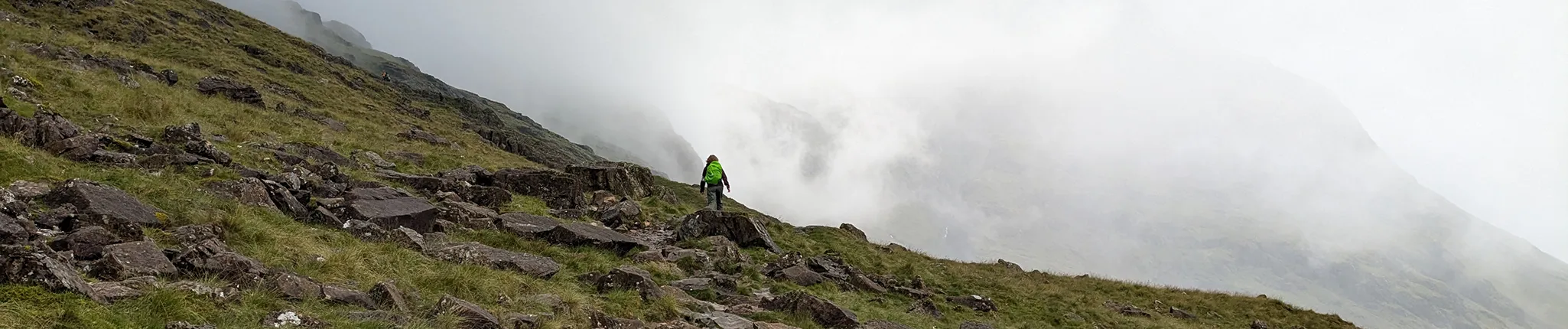
The summit area of Scafell Pike is a wide plateau of rocks and cairns. In poor visibility it can be difficult to identify the correct descent route, so checking your compass direction before leaving the summit is essential.
6. Return via Esk Hause and Angle Tarn
2. Make sure you leave the summit in the correct direction, as several paths descend from here.
3. Your route heads north-east, back towards Esk Hause between Great End and Esk Pike.
4. At this flattening (around 760m), instead of returning to Esk Pike, descend north-east on a wide path to a lower flattening marked by a stone cross-shaped shelter, which marks a key junction of mountain routes.
5. From the shelter, follow a well-used trail south-east and downhill for around 1.3 km towards Angle Tarn, sitting beneath the crags of Bow Fell’s Hanging Knotts.

6. Passing the tarn, the path climbs gently to a col between Rossett Pike (left) and Bow Fell.
7. Rossett Gill and Return to Langdale
1. From the col, a stone-pitched path descends steeply alongside Rossett Gill towards the valley. This descent can feel quite tiring, so it’s worth making sure you’ve eaten and drunk enough before starting down.
2. The path drops over 430 metres quite quickly, with rocky steps that can be demanding on tired legs.
3. At the bottom, cross a footbridge at the head of Mickleden valley, then follow the wide valley path for around 3 km back to the Old Dungeon Ghyll hotel and car park.
Further reading:
- Read our in-depth Scafell Pike For Beginners Guide »
- Find out what climbing Scafell Pike is like at different times of the year »
- Make sure you’ve got the right kit: check out our Essential Kit Guide »
Scafell Pike – Your Way
We run regular guided walks on Scafell Pike, giving you the chance to join a small, friendly group led by an experienced Mountain Leader. All of our open dates are guaranteed to run, whatever the group size – take a look at our upcoming dates to find one that works for you.
If you’d prefer a more personal experience, you can also book a private guided walk. Whether you’re climbing with friends, family or colleagues, one of our Mountain Leaders can tailor the day to your group, pace and goals.
We’re also long-standing providers of charity Scafell Pike climbs, supporting individuals and groups to raise money for good causes since 2010. Over the years, our walkers have raised thousands of pounds for both local and national charities. If you’re looking to add purpose to your climb, we can connect you with one of our Charity Partners or support your fundraising for a charity of your choice.
Questions?
We’re here to help – get in touch with our team with any Scafell Pike questions.