Scafell Pike via Brown Tongue from NT Lake Head Car Park Wasdale
This walking route on England’s highest mountain is the most accessible for transport access and navigation.
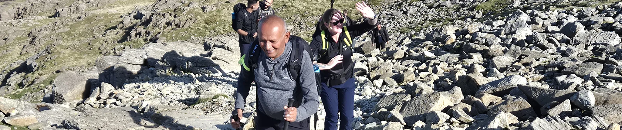
Even though the route is fairly straightforward in clear weather, using the same paths in ascent and descent, the terrain underfoot is rocky and steep at higher elevations. An exhilarating and dramatic route using the Hollow Stones area to ascend via the rocky heart of the mountain. A great choice if this is your first visit to the area.
Walk Summary:
- Distance: 5.5 miles / 9 km
- Ascent: 900m
- Time: 5-6 hours
- Start Point: National Trust Lake Head Car Park, Wasdale
- Grid Ref: NY 182 074
Maps:
- Ordnance Survey: OL6 English Lakes – SW
- Harvey Maps: British Mountain Map – Lake District
Your Starting Point
The National Trust Lake Head car park (and campsite) is the go-to access point for climbing Scafell Pike. The pay and display car park area is large with toilet access. It’s far more efficient to commit to parking here than trying to find alternative parking further up the valley at Wasdale Head (which is usually very busy and more impactful for the residents of Wasdale Head).
What 3 Words: spelling. cold. alongside
1. Starting the walk
1. Leave the car park area and pass through the small gate next to the cattle grid, then cross the large wooden bridge ahead of you. This bridge crosses the waters of Lingmell Gill, one of the streams draining the slopes of Scafell Pike.
2. Turn left, following signs for Eskdale / Miterdale (footpath to Scafell). Walk along the gravel footpath for a short distance until you reach another junction.
3. The bridleway to Eskdale / Miterdale branches off to the right here, but you should keep Lingmell Gill on your left and continue straight ahead through a small wooded area, passing the building Brackenclose on your right.
This path soon brings you to another bridge crossing Lingmell Gill, allowing you to access the northern side of the gill for the next stage of the climb.
Beyond this point you’ll enter Open Access land, where walkers have the legal right to roam across mountains, moorland and common land under the Countryside and Rights of Way Act (2000).
2. Lingmell Gill to Brown Tongue
1. On the other side of the gill, the stony path begins to climb and passes through a gate.
2. You’re now ascending the lower slopes of Scafell Pike along a well-trodden path that can be rocky in places.
3. Initially the route follows the base of Lingmell Gill until you reach a ford crossing. Most of the time this crossing is manageable with care, but after heavy rainfall the stream can become difficult or unsafe to cross.
4. After crossing the stream, the route climbs the grassy spur of Brown Tongue, beginning a steeper ascent towards an area known as Hollow Stones.

5. The path here is quite well engineered, with rocky slabs and steps, but it’s still steep and can feel tough at times. Take it steadily and settle into a comfortable pace as the angle begins to ease slightly above 550 metres, where a cairn marks the start of the Hollow Stones area.
Brown Tongue is one of the steepest sustained sections of the route. Taking short breaks and maintaining a steady rhythm can make the climb feel much more manageable.
3. Crossing Hollow Stones
1. The next 1 km crosses the undulating terrain of Hollow Stones, an impressive area within the Scafell Pike massif.

3. The section finishes with a zig-zag climb out of Hollow Stones onto a good gravel path, which feels much easier after the rocky steps below.
4. At around 700 metres, the route approaches the gap between the summit of Lingmell (on your left) and the final slopes of Scafell Pike (on your right).
5. You’ll arrive at the lowest point of this col at around 750 metres, where views open up towards Great Gable and the northern fells.
6. Turn right here to begin the final ascent towards Scafell Pike’s boulder-strewn summit, around 1 km away.
Many walkers pass beneath Lingmell, but it’s actually a separate Wainwright summit at 807 metres. It offers one of the best views of Scafell Pike’s western face.
4. Final Ascent to Scafell Pike
1. The final climb follows a rocky path marked by cairns, generally heading south-east.
2. The path zig-zags through larger boulders and rocky steps, aiming for a prominent cairn above 900 metres.
3. After passing this cairn, the route crosses slightly flatter ground for the final 400 metres to the summit.
5. The summit cairn itself is a large circular platform of stones, sitting on top of a natural rocky rise. In good weather it’s very obvious and hard to miss.
5. Descent via the Same Route
1. This walk uses the same route for the descent, but take care to leave the summit in the correct direction.
2. Several paths lead away from the rocky summit plateau, so it’s important to locate the correct line towards Lingmell Col.
3. From the summit, head north-west to pick up the rocky path. In clear weather you should be able to see the large cairn at around 900 metres, which marks the descent route.

4. Make sure you’ve packed enough food and water for the entire walk. Even though you’re descending, the route down from England’s highest mountain is still steep, rocky and demanding, just as it was on the way up
Scafell Pike – Your Way
We run regular guided walks on Scafell Pike, giving you the chance to join a small, friendly group led by an experienced Mountain Leader. All of our open dates are guaranteed to run, whatever the group size – take a look at our upcoming dates to find one that works for you.
If you’d prefer a more personal experience, you can also book a private guided walk. Whether you’re climbing with friends, family or colleagues, one of our Mountain Leaders can tailor the day to your group, pace and goals.
We’re also long-standing providers of charity Scafell Pike climbs, supporting individuals and groups to raise money for good causes since 2010. Over the years, our walkers have raised thousands of pounds for both local and national charities. If you’re looking to add purpose to your climb, we can connect you with one of our Charity Partners or support your fundraising for a charity of your choice.
Questions?
We’re here to help – get in touch with our team with any Scafell Pike questions.